Moat Lane, Towcester
National award,
Urban Design Group 2012
image courtesy of studio|REAL

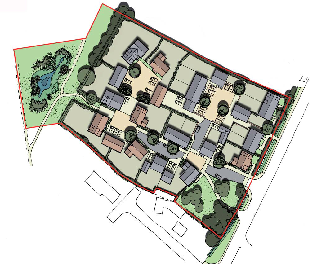
Illustrative masterplan: existing buildings brown, new grey and refurbished beige
Rob West led the Studio|REAL urban design team to the 2012 Practice Award for the Moat Lane regeneration project at Towcester.
The project was commissioned by South Northamptonshire Council to strengthen the town centre in anticipation of the major expansion of the town from some 9,000 to 16,000 people. The study noted the strong presence of local business and the potential to expand the town centre in the Moat Lane area immediately behind the main street, Watling Street. However, the area is of enormous environmental interest, with numerous listed buildings, a scheduled ancient monument, and a listed Capability Brown landscape alongside the River Tove.
The urban design approach was to extend the historic pattern of plots and lanes behind Watling Street into the area and to preserve all the historic built fabric, finding new uses that would both adapt comfortably to existing buildings and enhance Towcester’s market town functions. Comprehensive redevelopment through demolition was avoided. Uses include a typical town-centre mix of retail space, cafés and bars, employment, leisure and civic space, and a range of dwelling types: it was a conscious decision not to rely heavily on residential development for viability.

Restored Bury Mount in spring, viewed from the church tower
Implementing the masterplan involved some compulsory purchase by the Council and continuous public engagement. The first project was the rescue of a Norman motte and bailey, Bury Mount, and its establishment with the riverside at the centre of the project. The Council opted to downsize its offices into some of the employment space, commissioning a new civic centre which is close to completion, and the former mill is now established as a craft brewery.